Influence of forest magrove on increased deposition rate and wave attenuation in Ngoc Hai area (Hai Phong)
Abstract. Mangrove forests in Hai Phong coastal area are the ecosystem with high productivity. Mangroves forests also have a good role on protection dike and coastal residential area. The extending of alluvial deposition area and development of mangrove forest are two processes occur together. Base on the results study on the coastal zone of Ngoc Hai (Do Son, Hai Phong) since 2004 to 2011, this paper shown the role of mangrove forest on increased deposition rate, heighten bathymetry, and wave attenuation in Ngoc Hai area (Hai Phong). Deposition rate in the study could be increased about 0.1-0.4cm/year if mangroves age increasing one year age.
Bản toàn văn: http://tapchi.vnu.edu.vn/upload/2014/04/1305/7.pdf
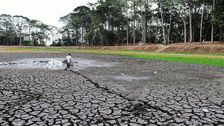
Risk assessment of flash – muddy flood and inundation of western Tam Dao mountainous region, Vinh Phuc province, Vietnam by using intergrated concept of hydrology and geomorphology
Abstract.Flash flood, muddy flood and inundation are three phenomena of hydrological hazard. Normally, they are logically appeared in a catchment. In some other cases at mountainous region, they are separately appeared. Studies on these phenomena are still incompleted. Case study f-rom area of Vinh Phuc Province, an intermediate watershed of Ca Lo River, located in Western Tam Dao Mountain which cover nearly all region of the Vinh Phuc Province. The performance of the concept was evaluated using statistical hydrological and geomorphological methods to assess the capability of the model in simulating the phenomena of flash flood, muddy flood in sloping regions and inundation in low land of the study area. By using ArcGIS 9.3 software, vertical eroded, watershed and stream accumulation, land cover, wetness index, geomorphology, and rainfall data layers have been cre-ated f-rom DEM, SPOT images, topographic maps, and statistical data. By overlaying these layers and then reclassifying the integrated layer, difference types of flood can be separated as muddy flood, flash flood along accumulation network and inundation in low land. These results are useful date for regional planning of the Vinh Phuc Province.
Keywords: flash and muddy flood, inundation, sub-basin, hydrology, geomorphology, average slope value, integration.
Bản toàn văn: http://tapchi.vnu.edu.vn/upload/2014/04/1304/6.pdf
Research on chromium removal in water by modified bentonite
Abstract. TThis research was conducted to produce a new natural derivated material (bentonite), which can remove chromium f-rom aquatic environment. Natural bentonite was activated by HCl acid, then by thermal factor at 1100C. Results of SEM images show that spongy and surface area of modified bentonite larger than natural bentonite. Chromium adsorption ability on modified bentonite depends on pH of solution, and adsorption capacity is almost stable in the pH range f-rom 3 to 6, then dramatically reduced f-rom pH 6-11. Maximum chromium adsorption capacity of modified bentonite - B90at-2 (13,89 mgCr/g) was much more than natural bentonite - B90 (3,32 mgCr/g). The modified bentonite can be used for waste water treatment with high concentration of chromium (140 mg/L) meet the vietnamese standard (QCVN 24:2009/BTNMT, B column).
Keywords: Modified Bentonite, montmorillonit, chromium, acid, adsorption.
Bản toàn văn: http://tapchi.vnu.edu.vn/upload/2014/04/1303/5.pdf
Model development for web - atlas system applying in administration management
Abstract. Traditionally, the maps are very important tools in government management and decision making. Nowadays, information technologies blooming as well as wide spreaded of internet involve the evolution in cartography technologies. The combining of cartography and internet creating new map generation - web maps. This new maps allow users see and apply it in any place which have internet connection. Web maps have many advences over traditional maps. Therefore, there are many researcher applying them in socio-economical and culture aspecs. This paper describes research results in development of a model for web atlas applying in administration management in Hanoi, Vietnam.
Keywords: Webatlas, Web Map, Electronic Atlas, Internet map, Administration management.
Bản toàn văn: http://tapchi.vnu.edu.vn/upload/2014/04/1302/4.pdf
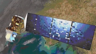
Estimation of the rice yield in the Mekong Delta using dual polarisation TerraSAR-X data
Abstract.Food security has currently become a key global issue due to rapid population growth in many parts of Asia, as well as the effects of climate change. For this reason, there is a need to develop a spatio-temporal monitoring system that can accurately assess rice area planted and rice production. Changes in rice cultivation systems have been observed in various countries of the world, especially in the Mekong Delta, Vietnam. The changes in cultural practices have impacts on remote sensing methods developed for rice monitoring, in particular, methods using new generation radar data. The objective of the study was to estimate the rice yield using new generation time-series Synthetic Aperture Radar (SAR) imagery.
Bản toàn văn: http://tapchi.vnu.edu.vn/upload/2014/04/1301/3.pdf
Diversifying Quang Binh tourism for a sustainable development orientation
Abstract. Tourism potential of Quang Binh province is abundant and diversity in typical sites such as white beautiful sandy beaches, the World heritage Phong Nha – Ke Bang and folk cultural types, national historical sites etc. Based on natural geographical, economical, social contidions. Quang Binh province is divided into 5 toursim center which is very specified by typical tourist types for each of them: - Phong Nha – Ke Bang center includes cave tour, Toi cave tour, telpher tour, climbing moutain in advanture tourist tour, fishing tour, yatch on Gianh river tour, ecological and geopark tour, 8 youth volunteer cave tour. - Dong Hoi center includes beaches tours, sandy bars tours, ecological tours in fighting village in Vietnam – America war and model of farmstead ecological tours on sandy bars, yath on the sea. - Da Nhay – Ly Hoa center includes beaches tours, sandy bars tours, farmsted ecological tours, National Park tours, historical sites tours across Gianh river. - Ngu Hoa – Le Thuy includes beaches tours, convalescene tours in hot spring Bang, General Vo Nguyen Giap house tours, historical and cultural tour as Ho Mai Nhi, fighting villages, 8 youth volunteers tomb tour... and sandy bars tours. - Quang Trach center includes sandy beaches, farmstead ecological tours, cave tours, Vung Chua – Bao Yen tours, historical and cultural tours across Gianh river.
Keywords: Phong Nha - Ke Bang; tourism potential; diversified tourism types.
Bản toàn văn: http://tapchi.vnu.edu.vn/upload/2014/04/1300/2.pdf
Geochemical c-haracteristics of Quaternary sediments in the Hanoi area
Abstract. 17 samples collected f-rom two drill holes (QO.01 and QO.03) at Quoc Oai (Hanoi) were analysed the main chemical compositions in oxides SiO2, TiO2, Al2O3, Fe2O3, MnO, MgO, CaO, Na2O, K2O by XRF method and some trace metal elements such as As, Cu, Pb, Zn, Sb, V, Cr, Ni, Cd by AAS method. According to these results, content of SiO2, Al2O3, Fe2O3 are the highest, the next is K2O, TiO2 and the other oxides are very low. The sediments in the Vinh Phuc formation have rich Fe2O3 by laterization, whe-reas those in the Hai Hung formation have rich K2O by the potassium-absorption in the organic matters. In the sediments, there are close relationship between the alkaline and alkaline earth elements, and the titan oxide is positively correlative with Al2O3 and Fe2O3.
Bản toàn văn: http://tapchi.vnu.edu.vn/upload/2014/04/1299/1.pdf