Toxicity of Surface Water Contamianted with Arthropogenic Pollutants to Micro-Crustacean, Daphnia magna Abstract: Arthropogenic pollutants are among the most serious problems to aquatic environment. They not only cause the water quality degradation but also induce severe impacts on aquatic organisms. In this study, we investigated the negative effects of surface water contaminated with pollutants f-rom human activities collected f-rom Xuan Huong lake, Da Lat city, on life history traits of Daphnia magna, over a period of 14 days. The animal was incubated in medium containing the contaminated surface water at eight different concentrations f-rom 0.05% to 25% (v/v) in the laboratory conditions. The results showed that the contaminated surface water seriously and negatively influenced on the survival of Daphnia, causing the decease of 27-100% of the exposed organism population, and the higher surface water concentration the animal exposed, the higher mortality it was. The contaminated water also delayed the maturity age of the tested organisms, around 3-8 days compared to the control. The maturity postponement was concentration dependent. Besides, the fecundity of the Daphnia exposed to the contaminated water was inhibited or strongly reduced. Heavy metals and pesticides in the surface water should be the main factors inducing the potent toxic impacts on the test organisms. Therefore, pollutants in the effluents f-rom human activities at Da Lat city should be effectively treated before disc-harged in order to protect the aquatic environment, biological resources and ecosystem.
Keywords: contaminated surface water, heavy metals, pesticides, Daphnia magna, life history traits .
Bản toàn văn: http://tapchi.vnu.edu.vn/upload/2015/11/1881/4.pdf File PDF Analysis of Rural-Urban Linkages in Fast Growing Cities for Enhancing Resilience to Natural Disasters (Case study: Đà Nẵng City, Vietnam) Abstract: The present study analyzed rural-urban linkages in Da Nang city, Vietnam, whe-re is undergoing high rates of urbanization. The research results showed that the rural-urban linkages provide many opportunities for mobilizing and exchanging migrants, commodities, capital, and innovation between rural areas and urban centers, and improvement disaster management systems of the city. The adequate development of transportation, communication and information services, education and health services in urban areas is an important fundamental for promoting connection between the urban and rural areas. The rural-urban linkages play crucial roles in enhancing the income of rural dwellers through the flow of cash f-rom the migrants and knowledge sharing on natural disasters and climate change between urban to rural areas. According to the climate change scenarios, the surface- and ground-water resource depletion is one of the greatest challenges of the rural communities in the northern districts and flood is a major threat to communities living in the low ground elevation and near the river basin in southern districts of the Da Nang city. The knowledge of the rural-urban linkages will provide more efficient means for enhancing resilience to natural disasters in the fast growing cities.
Keywords: urbanization, rural-urban linkages, climate change, Da Nang city. .
Bản toàn văn: http://tapchi.vnu.edu.vn/upload/2015/11/1882/5.pdf File PDF Premilinary Study in the Cause of Color in Zircon f-rom Krông Năng Mining Area in Đắk Lắk Province Abstract: Zircon occurs in many colors including various shades of pink, red, purple, yellow, orange, brown as well as less common shades of green, and blue. Generally, the colors of zircon are caused by the trace element composition (transition metals, lanthanides, actinides and REEs) and radiation damage (radiation induced color centers) [1]. The color centers of zircon are complex and the details surrounding the color-inducing mechanisms are still debated. The authors collected some zircon samples f-rom Krong Nang mining, Central Highlandss, using UV-Vis-NIR and FTIR techniques to determine the causes of their color. The UV-VIS-NIR absorption spectra of these samples show continuous increase absorption f-rom around 600 nm toward the UV region occasionally with shoulder at around 500 nm, which are identified as structural defect color center due to the radiation damage by radioactive elements such as U and Th. The OH- hydrous species was detected in all FTIR absorption spectra confirm a slight radiation damage by radioactive elements of zircon samples.
Keywords: Zircon, UV-Vis-NIR, FTIR. .
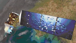
Bản toàn văn: http://tapchi.vnu.edu.vn/upload/2015/11/1883/6.pdf File PDF Permanent Water Bodies Mapping in the Mekong River Delta Using Seasonal Time Series C-band SAR Data Abstract: Microwave remote sensing or SAR (Synthetic Aperture Radar) data has been employed extensively to map open water bodies and to monitor flood extents, whe-re cloud cover often prohibits the use of satellite sensors operating at other wavelengths. Whe-re total inundation occurs, a low backscatter return is expected due to the specular reflection of SAR signal on the water surface. However, low local incidence angle and wind induced waves can cause a roughening of the water surface which result in a high return signal. It is also mean that the temporal variability (TV) of the backscatter f-rom water bodies is higher than other land surfaces. The Mekong River Delta is a region with very long wet season (starting in May and lasting until October-November), resulting in almost crop fields also has low backscatter returns. Whe-re such conditions occur adjacent to open water, this can make the separation of water and land problematic using SAR data. In this paper, we use seasonal time series C-band SAR data (dry season), we also examine how the variability in radar backscatter with incidence angle may be used to differentiate water f-rom land overcoming. We carry out regression over multiple sets of seasonal time series data, determined by a moving window encompassing consecutively-acquired ENVISAT ASAR Wide Swath Mode data, to derive three backscatter model parameters: the slope β of a linear model fitting backscatter against local incidence angle; the backscatter normalized at 50° using the linear model coefficients so(50o), and the minimum backscatter (MiB) f-rom time series data after normalized. A comparison of the three parameters (β, TV and MiB) shows that MiB in combination with TV provides the most robust means to segregate water f-rom land by a simple thresholding algorithm.
Keywords: Water bodies mapping, SAR, time series analysis. .
Bản toàn văn: http://tapchi.vnu.edu.vn/upload/2015/11/1878/1.pdf File PDF Lắng Đọng Trầm Tích Trong Các Đầm Phá: Tam Giang - Cầu Hai, Thị Nại và Nại ở Ven Bờ Miền Trung Việt Nam Tóm tắt: Lắng đọng trầm tích có ý nghĩa quan trọng với quá trình phát triển đầm phá ven bờ, sự tồn tại lâu dài hay suy tàn nhanh của đầm phá phụ thuộc vào các hoạt động tự nhiên và nhân sinh, lắng đọng trầm tích làm ảnh hưởng hàng loạt quá trình diễn thế sinh thái trong đầm phá. Bằng phân tích đồng vị phóng xạ 210Pb, 226Ra và mô hình tính tuổi CRS trong cột khoan đã theo dõi quá trình lắng đọng trầm tích trong 3 đầm phá ở ven biển miền Trung trong khoảng 150 năm trở lại đây. Tốc độ lắng đọng trầm tích dao động từ 0,11 - 0,30 cm/năm ở đầm Tam Giang – Cầu Hai, 0,08 - 0,72 cm/năm ở đầm Thị Nại và 0,39 - 3,44 cm/năm ở đầm Nại. So sánh tốc độ lắng đọng trầm tích của đầm Nại với các đầm phá miền Trung Việt Nam thì ở đầm Nại là lớn nhất, tốc độ lắng đọng trầm tích lớn sẽ làm nông hóa đầm phá và giảm đi những giá trị đa dạng sinh học và gây suy tàn nhanh đầm phá.
Từ khóa: lắng đọng trầm tích, 210Pb, đầm phá, trầm tích, miền Trung Việt Nam. .
Bản toàn văn: http://tapchi.vnu.edu.vn/upload/2015/11/1879/2.pdf File PDF Xây dựng Atlas điện tử dân cư thành phố Hà Nội Tóm tắt: Dân cư là một đối tượng luôn biến động theo thời gian, không gian. Để nghiên cứu dân cư một cách hiệu quả, ngoài yêu cầu trực quan hóa dữ liệu còn phải cho khả năng tương tác cập nhật thường xuyên, biến đổi hiển thị dữ liệu nhanh chóng. Xây dựng atlas điện tử về dân cư là giải pháp hợp lý đáp ứng các yêu cầu nêu trên. Nội dung của bài báo này trình bày về kết quả nghiên cứu, giới thiệu về Atlas điện tử Dân cư thành phố Hà Nội với khả năng tương tác hiển thị cập nhật thường xuyên, so sánh biến động một cách nhanh chóng và thuận tiện, tự động hiển thị các giá trị trên biểu đồ bản đồ... trên cơ sở ứng dụng phần mềm ARCGIS và lập trình thông qua ngôn ngữ C#.NET phiên bản 4.0 trong môi trường Visual Studio 2013 của hệ quản trị cơ sở dữ liệu MS Acces.
Từ khóa: atlas, atlas điện tử, dân cư Hà Nội. .
Bản toàn văn: http://tapchi.vnu.edu.vn/upload/2015/11/1880/3.pdf File PDF